(Undo revision 406166 by LaserAim (talk) Map Images category doesn't belong there.) |
Tag: Visual edit |
||
| Line 9: | Line 9: | ||
== Description == |
== Description == |
||
| − | Lemoyne has three smaller regions: [[Scarlett Meadows]], [[Bayou Nwa]], and [[Bluewater Marsh]]. A prison island |
+ | Lemoyne has three smaller regions: [[Scarlett Meadows]], [[Bayou Nwa]], and [[Bluewater Marsh]]. A prison island |
| + | [[File:Lemoyne Flag.png|thumb|220x220px|Flag of Lemoyne.]] |
||
| + | called the [[Sisika Penitentiary]] is located not far off from the territory. Lemoyne is bordered by [[New Hanover]] territories to the north and the [[Flat Iron Lake]] to the west and [[Lannahechee River]] to the east and south. |
||
| − | The territory is the most populated out of the other four states, despite the fact that is the smallest in size. It is mostly characterized by the massive crawl of industrialization and unique biomes. The state's capital, the former French colony of [[Saint Denis]], is located on the eastern shore of the state. Factories and orchards litter the wet swamplands of Bayou |
+ | The territory is the most populated out of the other four states, despite the fact that is the smallest in size. It is mostly characterized by the massive crawl of industrialization and unique biomes. The state's capital, the former French colony of [[Saint Denis]], is located on the eastern shore of the state. Factories and orchards litter the wet swamplands of Bayou |
| + | [[File:Lemoyne Coat of Arms.png|thumb|220x220px|Coat of Arms of Lemoyne.]] |
||
| + | Nwa; plantations, farmland, and the town of [[Rhodes]] can be found by Scarlett Meadows to the west; and the north-eastern region of Bluewater Marsh is relatively uninhabited due to its damp and muddy terrain. Notable plantations in Lemoyne are [[Caliga Hall]] and [[Braithwaite Manor]], belonging to the feuding [[Gray Family|Gray]] and [[Braithwaite Family|Braithwaite]] families, respectively. By the 1890s, the metropolis of Saint Denis, as well as another major settlement in Rhodes boost its numbers and its favourable geographic position and relatively hospitable conditions allow the state to flourish. |
||
In the past, Lemoyne was a member of the short-lived Confederate States of America during the Civil War (1861-1865), with many citizens of the state fighting against the North. Remnants of Civil War battlefields can be found deep within the meadows of the territory. Lemoyne is also the base of the ex-Confederate militia movement called the [[Lemoyne Raiders]], who are still bitter from the Civil War and are excessively patriotic of Lemoyne's former past. |
In the past, Lemoyne was a member of the short-lived Confederate States of America during the Civil War (1861-1865), with many citizens of the state fighting against the North. Remnants of Civil War battlefields can be found deep within the meadows of the territory. Lemoyne is also the base of the ex-Confederate militia movement called the [[Lemoyne Raiders]], who are still bitter from the Civil War and are excessively patriotic of Lemoyne's former past. |
||
Revision as of 07:36, 11 September 2020
Click to enlarge
| “ | Enjoy the lush meadows and southern climate of Lemoyne's countryside, or take in the lights in the cultural city of Saint Denis. That's if you make it through the foreboding marshland and Bayou Nwa. | „ |
| —Red Dead Online description |
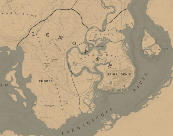
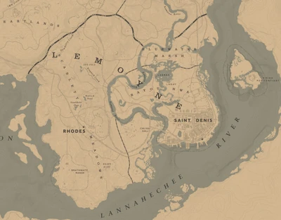
Lemoyne is a southern American state and one of the five American territories in Red Dead Redemption 2.
It is also home to the most civilized settlement of the Southwest, Saint Denis.
Description
Lemoyne has three smaller regions: Scarlett Meadows, Bayou Nwa, and Bluewater Marsh. A prison island


Flag of Lemoyne.
called the Sisika Penitentiary is located not far off from the territory. Lemoyne is bordered by New Hanover territories to the north and the Flat Iron Lake to the west and Lannahechee River to the east and south.
The territory is the most populated out of the other four states, despite the fact that is the smallest in size. It is mostly characterized by the massive crawl of industrialization and unique biomes. The state's capital, the former French colony of Saint Denis, is located on the eastern shore of the state. Factories and orchards litter the wet swamplands of Bayou


Coat of Arms of Lemoyne.
Nwa; plantations, farmland, and the town of Rhodes can be found by Scarlett Meadows to the west; and the north-eastern region of Bluewater Marsh is relatively uninhabited due to its damp and muddy terrain. Notable plantations in Lemoyne are Caliga Hall and Braithwaite Manor, belonging to the feuding Gray and Braithwaite families, respectively. By the 1890s, the metropolis of Saint Denis, as well as another major settlement in Rhodes boost its numbers and its favourable geographic position and relatively hospitable conditions allow the state to flourish.
In the past, Lemoyne was a member of the short-lived Confederate States of America during the Civil War (1861-1865), with many citizens of the state fighting against the North. Remnants of Civil War battlefields can be found deep within the meadows of the territory. Lemoyne is also the base of the ex-Confederate militia movement called the Lemoyne Raiders, who are still bitter from the Civil War and are excessively patriotic of Lemoyne's former past.
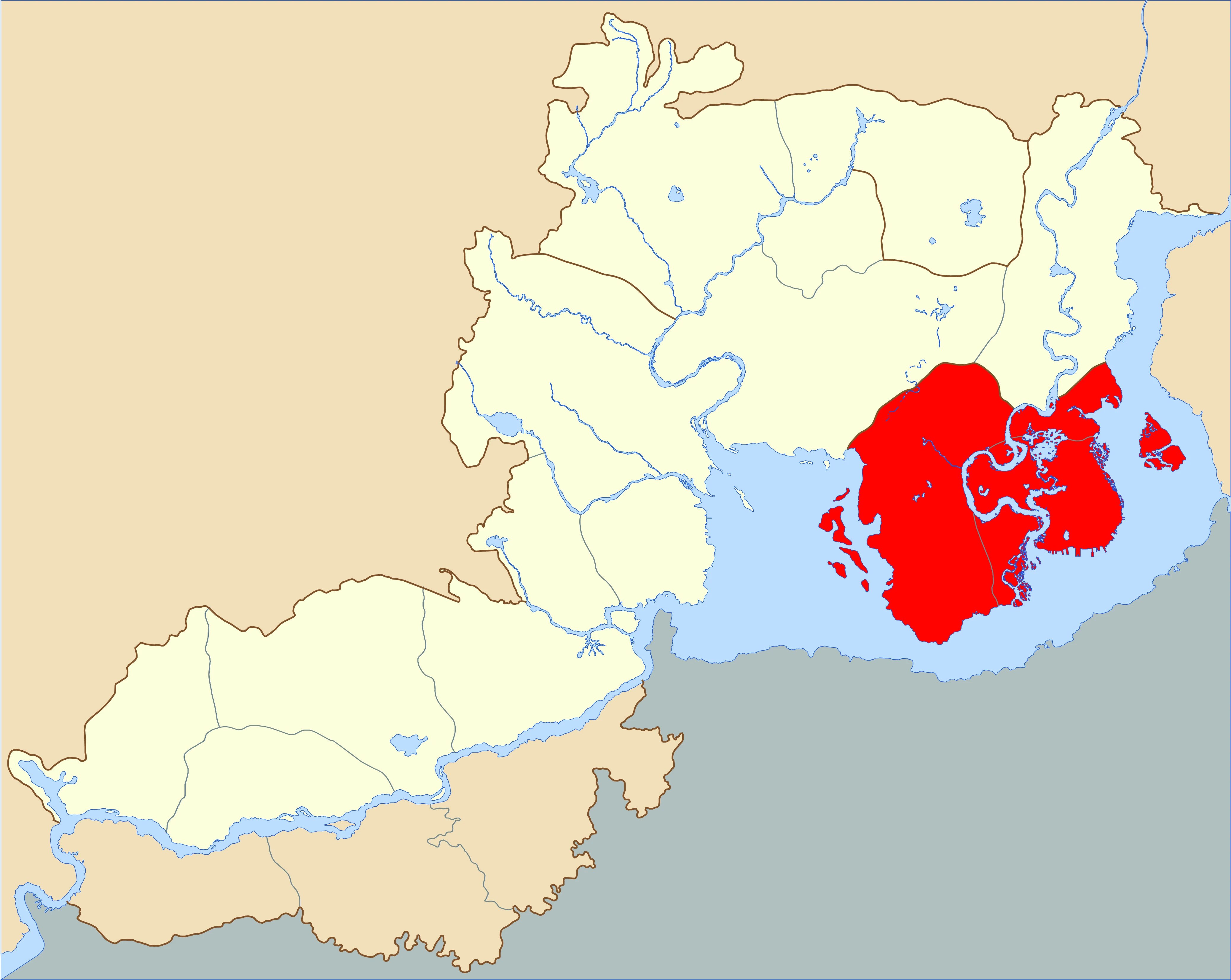
Geography

Map of the Southwestern US as shown in-game, with Lemoyne highlighted in red.
The western portion of Lemoyne consists of lush rolling hills, red-earth soil, pastures, and ponds that make up Scarlett Meadows. Dewberry Creek, a dried creek, is found within the borders of the meadows. Low-level shrubs and short grass primarily grow in the region, which is suitable for grazing and ranching.
The eastern part of the state (Bayou Nwa and Bluewater Marsh) consists of mostly marshes, floodplains, and swampland, where the American alligator and various semi-exotic creatures are found. Kamassa River feeds the bayous of the territory, where stagnant water rests before emptying to Lannahechee River. Hardwood trees abundantly grow within the nutrient-rich swampland of Bayou Nwa.
Lemoyne is directly based on the state of Louisiana, the two even sharing similar names. Being a giant forest-like marshland near the Gulf of Mexico, both Lemoyne and Louisiana have major metropolitan areas (Saint Denis and New Orleans, respectively) as well as French/African-American heritage and a Confederate Civil War history.
- Scarlett Meadows is heavily reminiscent of the regions of Northern and Central Louisiana, especially those surrounding the Red River. The red clay soil, forests, small rivers and ponds, and rolling hills would be commonly found in this region of Louisiana, as well as the rest of the Dixie (Mississippi, Alabama, and Georgia).
- Bayou Nwa is directly based on the various bayous and swamps in lower Louisiana, including Saint Denis being a stand-in for New Orleans.
- Bluewater Marsh is more akin to coastal Louisiana bordering the Gulf of Mexico and the Mississippi River, including the marshes and wetlands in this region.
- The Lannahechee River serves as the game's version of the Mississippi River, whereas the Kamassa River seems to be based on the Ouachita River.
Locations in Lemoyne
Scarlett Meadows
- Abandoned Church
- Aberdeen Pig Farm
- Argil Rise
- Braithwaite Manor
- Bolger Glade
- Catfish Jacksons
- Clemens Cove
- Clemens Point
- Compson's Stead
- Dewberry Creek
- Eris Field
- Face Rock
- Flat Iron Lake
- Hill Haven Ranch
- Lannahechee River
- Lonnie's Shack
- Mattock Pond
- Old Greenbank Mill
- Old Harry Fen
- Old Trail Rise
- Pleasance
- Radley's House
- Radley's Pasture
- Rhodes
- Robard Farm
- Ringneck Creek
- Siltwater Strand
- Southfield Flats
Bayou Nwa
Bluewater Marsh
Gallery
")
")
")
")
")
")
Trivia
- Lemoyne comes from the French word for "the monk" ("le moine"). One other possible source for the name may have been Jean-Baptiste Le Moyne, Sieur de Bienville, who served as the French Colonial Governor of Louisiana from 1701 to 1713.
- "Lemoyne" is also a common French surname, although the spelling and even pronunciation can vary.
- Lemoyne is the only state/territory depicted in the series so far to be completely based on chiefly one real-life state (Louisiana); all other depicted states/territories combine elements of multiple real-life equivalents.
- Despite the ongoing unrest with the Lemoyne Raiders and deep-seated racial tensions following the American Civil War, Lemoyne is by far the most ethnically diverse state in the game, with Anglo, French, Cajun, African-American, Chinese, and Italian people all living side-by-side. It also reflects the real-life Louisiana history with French, Spanish, British, and American influence as well as New Orleans (or in this case Saint Denis) having a large population of immigrants.
- Although the game broadly presents some realistic elements of de facto racial segregation (neighborhoods, poverty, and quality of life, labor divisions, etc.), its legal enforcement (such as the infamous Jim Crow laws) is not explicitly depicted or discussed. Plessy v. Ferguson (a decision on a state case revolving around real-life Louisiana and New Orleans in particular) upheld state and local segregation laws in 1896 with the ostensible demand for “separate but equal” quality for blacks and whites among public facilities.
- When the player is in Lemoyne, the ambient music will change to a more distinct southern/Creole-style ambient theme unique only to the state.
- The Van der Linde gang makes their camp in Clemens Point and Shady Belle during chapters 3 and 4 respectively. They also set up camp briefly in Lakay near the end of chapter 5.
| ||||||||||||||||||||||||||||||||
| |||||||||||