Locations in Red Dead Redemption represent the gameplay world and
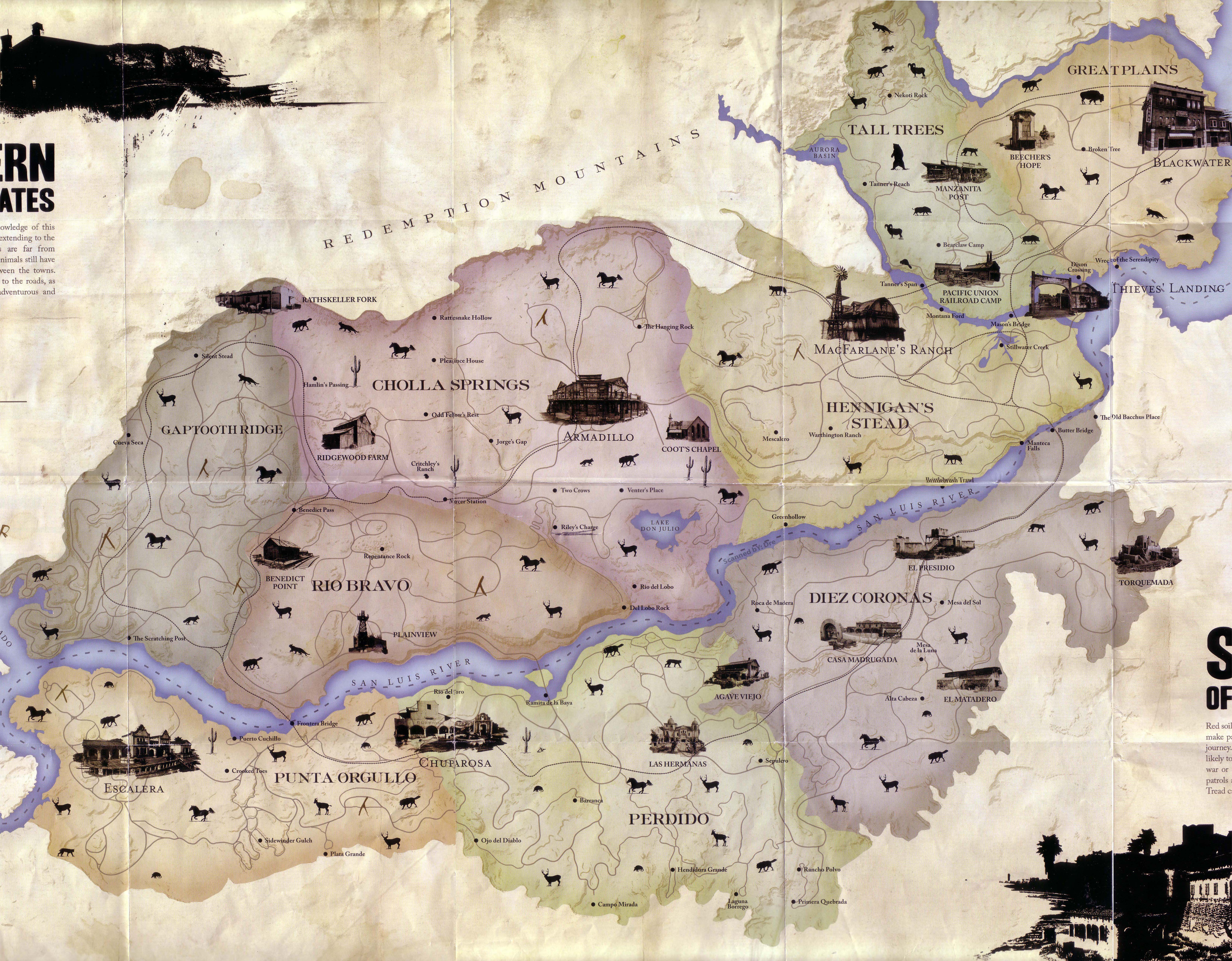
A map of the world of Red Dead Redemption.
consist of three primary territories, each split into a varying number of constituent regions. This area is based on the Rio Grande Basin in Texas/Mexico.
Within each of these regions, there are settlements, outlaw hideouts, major geographical features, ore mines, bridges, rivers, lakes, camps, outposts, railroads and much more.
The San Luis River runs between New Austin and Nuevo Paraiso, which then appears to empty into the Sea of Coronado. There are also lakes scattered throughout the frontier like Lake Don Julio, which is located in the southern portion of Cholla Springs.
Fagg
Click to zoom in
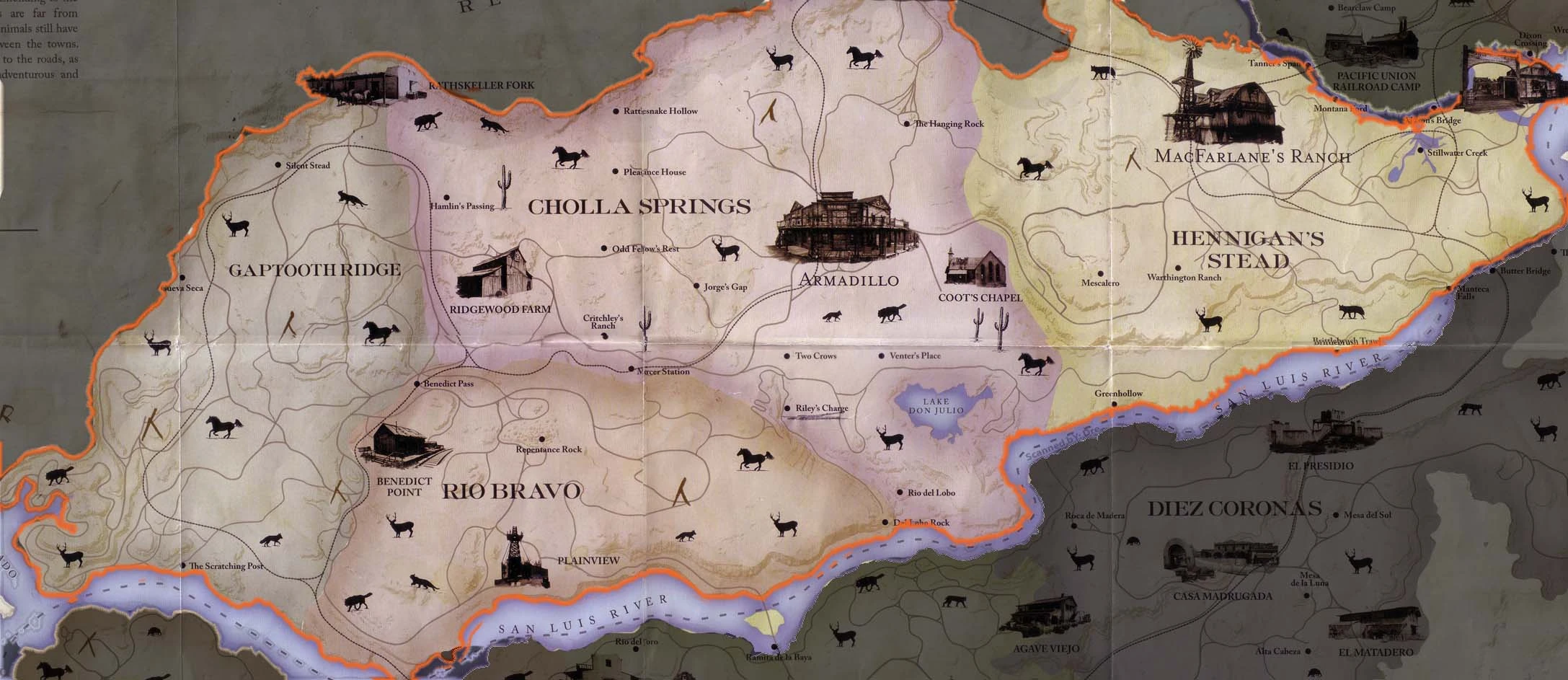
New Austin is the first explorable territory available to the player at the start of a new game. The New Austin territory consists of 4 regions (and is located west of West Elizabeth): Cholla Springs, Río Bravo, Gaptooth Ridge, and Hennigan's Stead. Within New Austin the towns of Armadillo, Plainview, Thieves' Landing, Rathskeller Fork and the ghost town Tumbleweed preside. Also contained within this area are Ridgewood Farm, MacFarlane's Ranch and Fort Mercer.
Vector Map of New Austin
In this area are two locations that sometimes do not show up as places found even after purchasing and using the map for this area. Tanner's Span and Mason's Bridge are two railway bridges SW & SE respectively of the Pacific Union Railroad Camp. Crossing these bridges will unlock these two locations and count towards 100% completion.
Nuevo Paraiso
Click to zoom in
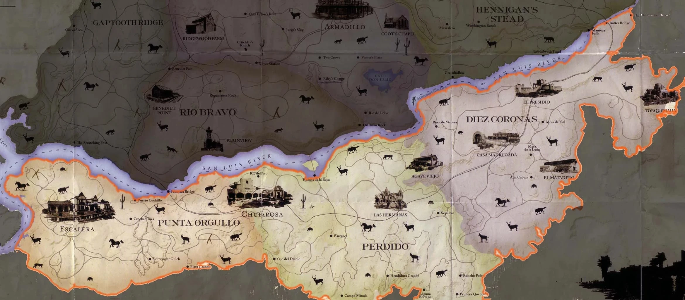
Nuevo Paraiso (Commonly called Mexico within the game) is the second explorable territory. It is unlocked in the story mission We Shall Be Together In Paradise. The Nuevo Paraiso territory consists of three regions (and is located south of the river and south of New Austin) : Punta Orgullo, Perdido, and Diez Coronas. Within this area are the towns of Chuparosa, Escalera, the fortress of El Presidio, the monastery of Las Hermanas and the settlements of Agave Viejo, El Matadero, Torquemada and Casa Madrugada.
West Elizabeth
Click to zoom in
West Elizabeth is the third and final explorable territory. It must also be unlocked through story missions before it can be explored. West Elizabeth consists of Tall Trees to the north-west and the Great Plains making up for the most of West Elizabeth. West Elizabeth has a mountain called Nekoti Rock, home to many Grizzly Bears. The town of Blackwater (Where John Marston passes through in the first cut scene) lies on West Elizabeth's eastern coast while the smaller Manzanita Post resides in Tall Trees.
| |||||||||||||||||||||||||||||
| ||||||||||||||||||||